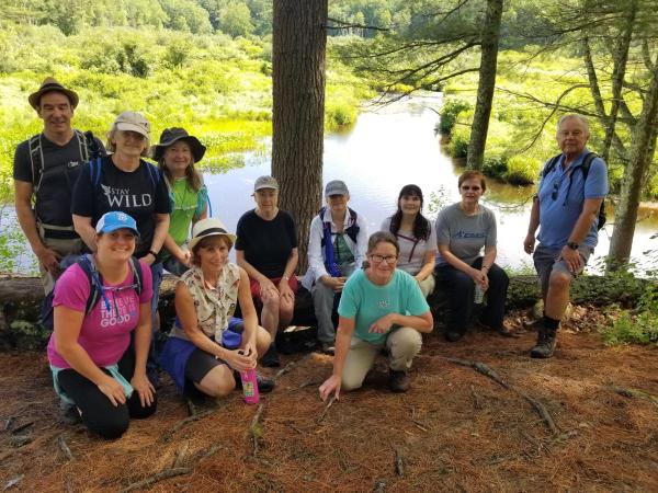
Ware River Rail Trail (Barre)
HIKE NAME: Ware Rive Rail Trail South DISTANCE: 6.4 miles DIFFICULTY: Easy-Moderate
Restrictions: Dogs must be leashed. No bikes or horses.
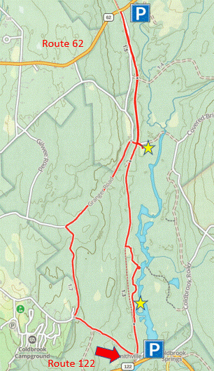
Trail Description: This is a well-maintained rail trail along the Ware River over mostly gravel roads. The hike goes from route 122 in Barre to route 62 in Hubbardston, and then loops around over a small hill in the return. 250 feet of elevation gain. The Ware River Rail Trail continues north from route 62 to Templeton and then to Baldwinville (with a break for route 2) and to Winchendon...a very long and mostly passable rail trail.
Links: None
Trailhead: Barre. Park on the east side of route 122 by the Kayak Boat Launch. This is 4.6 Miles north of the junction of Routes 122 and 122A in Rutland.. https://maps.app.goo.gl/i3C6uZs1U2v2yq5u9
Hike Details: Go through the gate and follow the rail trail north along the Ware River. Bear right on a small path to go out along the shore of the river to a pretty spot. Continue back onto the rail trail.
After hiking two miles, Riverside Cemetery will appear to the right. This abandoned cemetery, once a part of Coldbrook Village, is known for the grave of Elizabeth Naramore who, when faced with the removal of her children decided to kill them and take her own life. A monument to them is found in the back of the cemetery, down a small hill.
For this hike, we walked the remaining distance up to route 62, then turned around and returned to the vicinity of the cemetery, then took a right hand turn to climb up a quiet gravel road and over a large hill, before descending to the parking lot.
Other Options to Consider
Several alternatives can be considered to lengthen or shorten the hike. One is to walk only the mile out to the cemetery and back. Another is to skip the hill and do an out-and-back hike to route 62. You can also start at route 62 and hike south.
The other sections of the Ware River Rail Trail are also interesting to explore. The section from route 62 to Williamsville Road is 3 miles in length, and another five miles takes you to route 101 in Templeton. With a car drop, this 8 mile walk is pleasant but does not have a lot of really scenic features.
Rev 1/24