

West Boylston - Wachusett Reservoir Southwest
HIKE NAME: Wachusett Reservoir SW DISTANCE: 6 Miles DIFFICULTY: Moderate
Restrictions: No dogs or bikes, No motorized vehicles
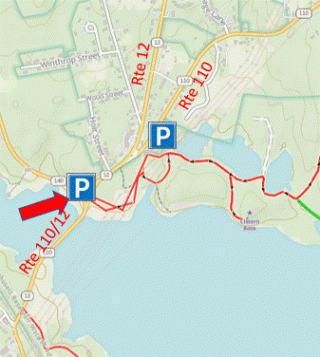
Trailhead: West Boylston. Park where Routes 140 and 12/110 split, a triangle on the north side of the Route 12 causeway. This is close to the Old Stone Church. Park along the side of the road. https://maps.app.goo.gl/ShMmf5cdFLafhZEDA
Hike Description: Walk along the Wachusett Reservoir and through the woods over French Hill to isolated Sholan Point, with a fine view across the water. Return on gravel roads, some of which contain house foundations. Trail marker/intersection numbers are displayed at some intersections and are referred to below. Total elevation is 800 feet.
Links: Wachusett Reservoir Roads and Gates
Hike Details:
From the parking area, cross Route 12 and proceed through the gate onto the open area beside the reservoir. Follow until a trail appears on the left through the ceder trees.
Follow this gravel road over some small hills and then to the right before it merges onto a wide gravel road by the first of three ponds. This walk eventually comes to a large intersection at trail marker #113.
Take a left (refer to map) at this point and start uphill. Soon there will be a sharp right at Marker #115, which proceeds up French Hill and a very open forest. Eventually this levels out and a road goes off to the right at trail marker #118. Continue on the main trail to marker #119.
Take the right at marker #119 and proceed down the hill, with a large switchback until arriving (trail marker #120) at a large road that runs along the shore of the reservoir. The broad road to the right can be explored if desired, and optionally you can take this route back on the trail marked in green.
Turn left at this road and continue past the end of the inlet until a road runs to the right at marker #134. Take that road and proceed to the shore of the reservoir, passing a road on the right (marker #135). Enjoy the view! This is a nice secluded spot, enjoyed by fishermen.
Reverse direction, and this time explore the road that heads to the left, out to Sholan Point. The road ends and a trail goes up a rocky crag with a nice view over to the south end of the reservoir. This is a good spot for a snack.
Return to the main road and turn left to return to the inlet. Follow the roads as shown on the map, staying on the broad gravel roads and passing by markers #139, #141, #127, and #124 before arriving back at marker #115.
A GPS App is highly recommended when walking in this part of the Wachusett Reservoir system.
Other Options to Consider:
There are plenty of alternate routes in this area, including some routes that go close to the shore.
For the return trip, a shorter route is to proceed as shown in the green line on the map, which follows fishing trails along the edge of the reservoir. These trails are not always well maintained, and so some bushwhacking may be required.
Another shorter option is just to go out to Sholan Point and then return via the same route.
Historical Notes:
The Wachusett Reservoir was built between 1900 and 1910 to serve as a water supply for the city of Boston. Water is dammed in Clinton and fed to Boston through a series of aqueducts.
The reservoir displaced the town of West Boylston, which was originally centered around the Old Stone Church that stands just across the reservoir from the Route 12 parking area.
Rev 1/24
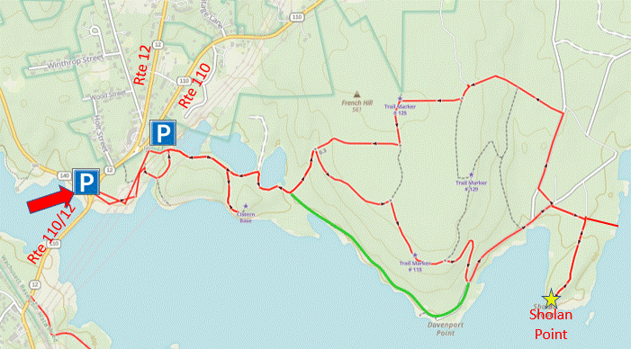
Map of the Wachusett Reservoir Southwest Hike
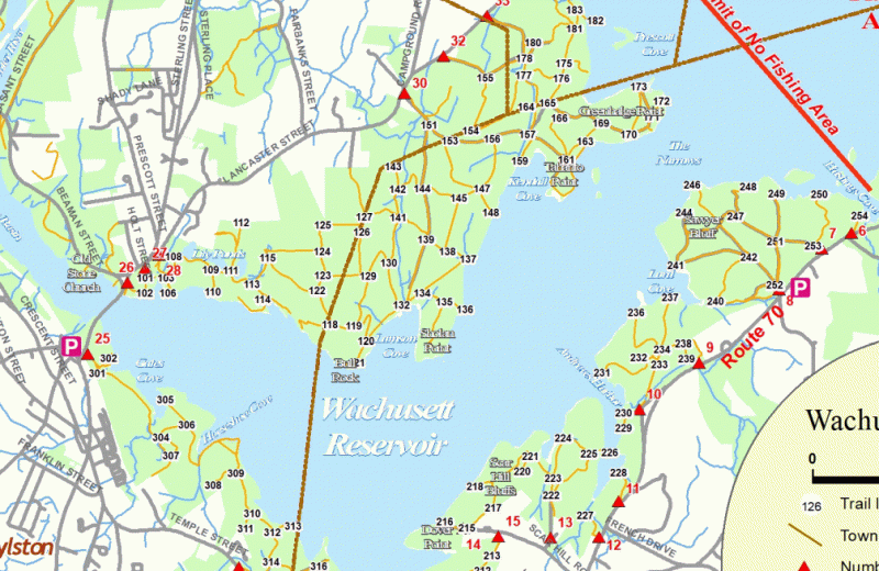
Wachusett Reservoir Trail Markers are useful in navigating the extensive road system