

LSF Crow Hill North
HIKE NAME: Leominster State Forest Crow Hills North Loop DISTANCE: 3.5 Miles DIFFICULTY: Moderate
Restrictions: No motorized vehicles
Trailhead: Rocky Pond Trailhead, which is just north of Paradise Pond on the right, off Route 31. This is a large parking lot with room for 20 or so cars. https://goo.gl/maps/i4XVR6Y9g8su7Rfj6
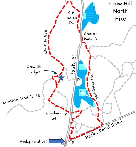
Hike Description: This hike goes to the base of the impressive Crow Hill Ledges (yellow star on map), a favorite rock climbing destination. It then goes over the top of the ledges and then over South and North Crow hills before descending back to the LSF swimming area, and continuing along the Crow Hill Ponds back to the Rocky Pond Trailhead. There are some very nice views along the top of the cliffs. There is one steep rock scramble when ascending the cliffs, and is briefly steep when coming down after summitting North Crow Hill. The hike can be slippery in the fall when the oak leaves coat the trail. Total elevation gain is 650 feet.
Links: LSF Trail Map
Hike Details:
From the Rocky Pond Parking Lot, take the Sawyer Run trail closest to route 31 North, which enters into a pine forest.
A quarter mile in, before reaching the Crow Hill Ponds, take a sharp left to go down to Route 31, and cross the road to the climbers parking lot. Take the access road (a gravel road) up the hill and proceed along the trail to the bottom of the cliffs. This is a great photo spot and often climbers can be observed scaling the cliffs..
Reverse direction and make your way around to the south/west of the cliffs, and then pick up the Midstate Trail to the north, a sharp right hand turn.
The Midstate Trail goes sharply uphill at this point, scrambling over rocks for a few hundred feet before leveling out at the top of the cliff and bearing right to the cliff side of South Crow Hill. There is a lovely view at this point over Leominster State Forest, with some open rocks that are great for a snack or picnic.
Continue north on the Midstate Trail, passing over North Crow Hill, where there are some nice icicle spots in the winter. Then descend on the far side of North Crow Hill. This area can be slippery in the fall.
Make a sharp right turn onto Old Indian Trail and descend back to Route 31
Cross Route 31 and go slightly to the right, then climb over the barrier to pick up the Crocker Pond Trail. This crosses a brook on a small bridge and then winds its way up to the swimming area parking lot. It can be wet in the spring.
Continue across the parking lot to the south, and pick up the Wolf Rock Trail which skirts the pretty Crow Hill Ponds and returns to Rocky Pond Road. Turn right at that point to return to the Rocky Pond trailhead.
Other Options to Consider:
A shorter option of the hike is to start at the Crow Hill Trail, which is across the street from the Princeton Lot parking area (right at the town line on route 31). This is a steep trail and the area up by the cliffs can be quite rough but saves close to a mile on the total hike. This parking area is closed in the summertime when the swimming area is open.
Historical Notes:
Rev 01/24
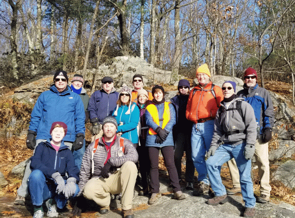
Hikers at the Crow hill South lookout
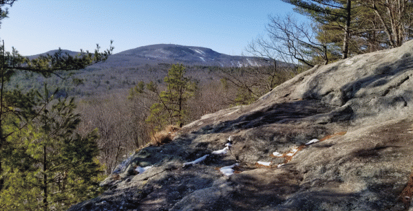
Wachusett Mountain from the lookout