Poutwater Pond From Thompson Gardens
Trail Head: Thompson Gardens Parking Lot (near Burpee Rd)
Distance and Difficulty: 3-4 Miles, moderate
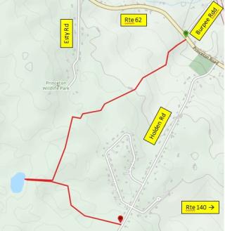
There are many ways to walk to Poutwater Pond including the route from Thomas Prince School, a shorter walk from the end of Esty Road. and an easy hike in from Holden Road (Sterling Road in Holden). This route walks up the hill from near the corner of Routes 140 and 62, through a couple of fields, and into the Pond Area. An optional extension of the walk to the Sterling Road trail head is shown in the map.
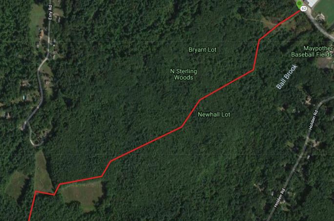
From the trail head by Thompson Garden, cross the street and enter through the DCR gate. Follow the mowed trail briefly, and then leave the mowed trail to the left to hit a wood road that goes up a long gradual hill to an open field. Thid larger field can be bypassed to the right trough the woods (see Satellite map below. The first turn is tricky!)
Skirt a second field on the left side, and then follow wood roads to the left (south) to the Poutwater Pond area.
Poutwater Pond is well known in the area for birding and flora, including orchids and other water plants. Some matting has bene added around the side of the pond for better views of the wildlife.
A trail can be followed to the south to the Holden/Sterling Road trail head.
These trails are all unmarked by DCR, so a GPS is a useful tool to bring along!
This is DCR property so Dogs and Bikes are not allowed, but Snowshoeing and Cross Country Skiing are welcome. there is Poison Ivy in several places along this route, so long pants are recommended!