

Savage Hill Loop
HIKE NAME: Savage Hill Midstate Trail DISTANCE: 4 Mils DIFFICULTY: Easy-Moderate
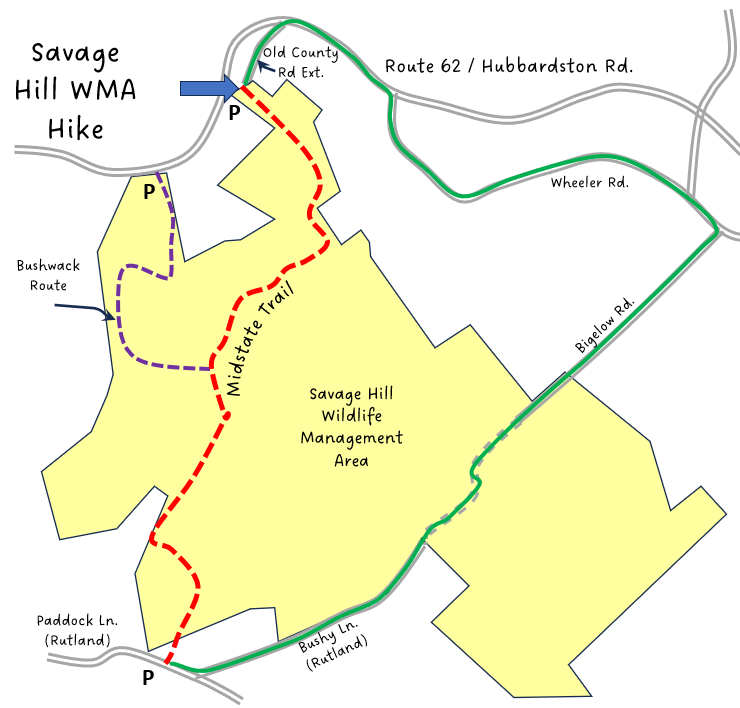
Trailhead: Princeton. Small parking area at the end of Old Colony Road Extension, which is off Route 62, 4 miles west of the center of town, on the left. https://goo.gl/maps/k3BLmRxh5ed51EgU8
Hike Description: This is an “out and back” hike on the Midstate Trail, which traverses Savage Hill Wildlife Management Area and connects between Old Colony Road in Princeton and Paddock Road in Rutland. It starts on old farm roads and continues on smaller but well-traveled snaking trails. The start of the hike is a gradual ascent, but after the first half mile levels out for the rest of the way. Total elevation is about 300 feet.
Links: (None)
Hike Details:
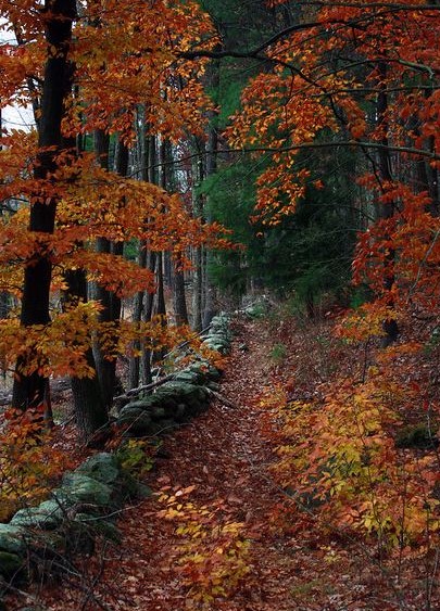
From the parking lot, follow the yellow triangular Midstate trail signs. There are numerous side trails, so make sure to continue to follow the trail markers through to Paddock Lane. There are stone walls beside the path for much of the distance.
After two miles, at Paddock Road in Rutland, reverse course and return to the parking area.
Other Options to Consider:
The hike can be extended by starting at Four Corners or the pedestrian bridge on Old Colony Road to hike more of the Midstate Trail, or by continuing on the Midstate Trail towards Barre.
A 6.5 mile loop can be made by hiking via Paddock Lane to Bushy Lane to Bigelow Road. Then take Wheeler Road left to Route 62 and turn left to return to Old Colony Road Extension. The area between Bushy Road and Bigelow Road is rough and may be muddy in a few places but crosses a pretty wetland, and is easy to follow. See Green Line on Map.
For people who like to explore, there is plenty of interesting land to the northwest of the trail, including a large wetland. The summit of Savage Hill can be climbed on a rough path that goes from the main parking lot for Savage hill, which is a bit further west on Route 62 from Old Colony Road Extension. This path does terminate near the top of Savage Hill. See dotted purple line on map for an idea of a bushwhack.
Historical Notes:
Savage Hill is a Massachusetts Wildlife Management Area, managed by DCR Fisheries and Wildlife. Passive recreation is allowed throughout. New trails and mapping are not allowed by DCR, however there are some small informal trails in the south side of the WMA that can be explored.
This area historically contained a large farm owned by the Savage Family, and was the home of early American Painter Edward Savage. Savage was a self-taught painter who painted perhaps the most well known of the portraits of George Washington’s family. Many of his works may be found at the National Gallery, the Boston Museum of Fine Art, and the Worcester Art Museum.
Rev 1/24
2017 Princeton Hike to Savage Hill
Savage Hill Midstate Trail