

Wachusett South Loop
HIKE NAME: Wachusett South Loop DISTANCE: 3 miles DIFFICULTY: Moderate
Restrictions: Dogs must be leashed. No bikes or horses.
Trail Description: This is a heavily trafficked loop trail that is moderate in difficulty with some steep sections. It reaches the summit and passes through some lovely forests and a section of wildflowers. 1,000 feet of elevation gain.
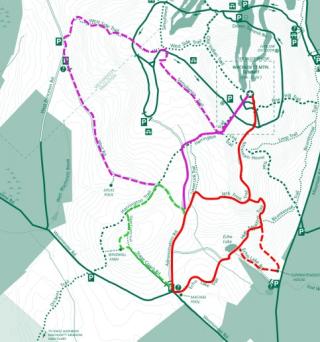
Links: Full Wachusett Mountain Map
Trailhead: Princeton. The gate at the intersection of Westminster Road and Administration Road (about one mile up Westminster Road from Mountain Road). Park along Westminster Road. https://goo.gl/maps/NQJWHCQ2zfGfLBHn7
Hike Details:
From the gate on Administration Road, hike up the gravel road to the Jack Frost Trail sign (0.4 miles on the right).
Hike Jack Frost Trail through a nice stand of Mountain Laurel (can be wet in spring, beautiful in June), cross some bridges and then ascend the steep rocks to get to the top of the ridge and the intersection with High Meadow Trail. This can be a challenging climb with multiple possible ways through the rocks. Follow the blazes to stay on track.
Continue on Jack Frost, to the left, along the Wachusett ridge and through a nice stand of pine trees, until the intersection with the Mountain House Trail. Turn left and cross the ‘Up’ paved road to reach the summit. Enjoy the view and kiosks at the summit.
Return down Mountain House Trail and then (0.5 miles from the summit at a major trail junction) take a right on Jack Frost Trail. Pass through the stand of hemlocks and out to the ridge. At the intersection with High Meadow Trail, turn left onto High Meadow and descend sharply down from the ridge. As you are reaching level ground, note a section of wildflower diversity on both sides of the trail, especially the right, that is beautiful in the spring. Continue on the level trail to High Meadow and its open field with views and a bench.
There are two options from High Meadow. One is to walk through the meadow and bear left before the trees to an access road, which leads to Mountainside Cafe, a convenient stop for baked goods, coffee, or lunch. From there, cut across the back to Echo Lake Road (gravel) and back up (right) to Echo Lake. Or a second option from High Meadow: continue on the High Meadow Trail down to Echo Lake. This section requires stepping over downed trees and can be quite wet.
Echo Lake offers a place for picnicking and nice views.. From here, continue on Echo Lake Road past the pond, and a little beyond take a left onto Echo Lake Trail. This will return you to the parking area.
Other Options to Consider
Several alternatives can be considered to lengthen or shorten the hike.
From the trail head you can take a short (but uphill) walk up Stagecoach trail to the Princeton Windmills. Then continue on Stage Coach Trail down to the Harrington Trail and turn right to wrap back around to Jack Frost by way of West Road. See green dotted line
From Administration Road, you can go past Jack Frost Trail to avoid the rock climb, and take the next right onto Harrington Trail and follow it to the summit. Harrington Trail has a steep uphill section and also a nice outlook to the west part way up the steep section. See purple solid line.
- Alternatively on the Harrington Trail you can take the Upper Link Trail to bypass the steep section of Harrington on the way to the summit.
Two miles can be added to this route by heading down West Road and then back up West Side Trail and across Semuhenna Trail to connect to Harrington. See purple dotted line.
Rev 1/24
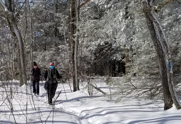
At the top of Jack Frost in Winter
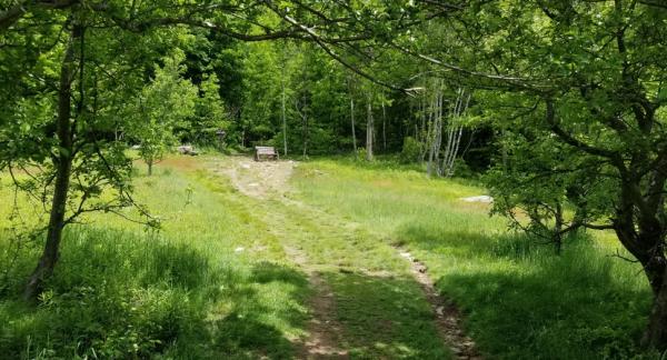
High Meadow in Summer