

Princeton Land Trust Bullock McElroy Trails
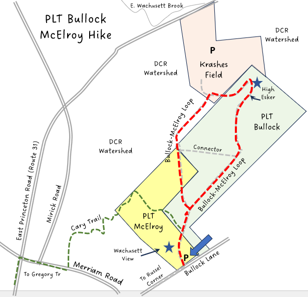
HIKE NAME: PLT Bullock-McElroy Loop Loop DISTANCE: 1.1 Miles DIFFICULTY Easy
Restrictions: No motorized vehicles
Trailhead: Princeton. Bullock Lane, about 200 yards down the lane from Rt. 62. Park in the field. You can also use the trailhead at the Krashes Field parking area. Follow hiking signs to the walking track and then over to the Kiosk. https://goo.gl/maps/NyCAm1i36c2htJ8q9
Hike Description: This hike loops around the Bullock-McElroy Princeton Land Trust (PLT) property. It passes over the high esker next to Krashes field and goes through the Bullock and McElroy Fields with a fine view of Mount Wachusett. Total elevation is 153 feet.
These two properties are owned by Princeton Land Trust and were donated for permanent conservation by the Bullock and McElroy families. The Land Trust has pledged to keep the fields cleared to maintain the beauty of the area.
Links: Bullock McElroy Kiosk
Hike Details:
From the parking area, follow the path through the field to the kiosk, then continue straight down the trail to the second field and then across the field to the stone wall by the forest.
Before the stone wall, bear left and follow the west side of the loop into the woods. The trail winds through a deciduous forest (which can be wet at times). At the next trail junction, take a left through a stone wall, following a pretty broad path down the hill toward Krashes Field.
Continue right around the loop next to Krashes Field and work through the woods (wet at times) and climb the steep side of the Esker. Turn left at the top of the esker to check the view at the end, and then reverse direction and follow the trail back along the top of the esker and gradually down to the forest floor. Notice a large ‘basin’ on the right as you walk along the esker..
Continue on the loop trail through the woods, turning left at the next trail junction, and return back around to the open field, and continue through the field to the kiosk and the trailhead at Bullock Lane. Turn around at this point at the McElroy dedication stone to get a nice view of Mt. Wachusett.
Other Options to Consider:
Stop by at Krashes Field to enjoy the view of Mt. Wachusett and the playing fields.
The Cary Trail can be used as a spur to walk back over to Merriam Road. With a short road walk back to Bullock Lane, a half mile can be added to the loop. The Cary Trail can be wet at times over a short portion of the path.
The ‘Central Princeton Loop’ is a five mile trail that visits all three of the Princeton Land Trust properties in the area using the connections to PLT Peabody and Princeton center which show at the bottom of the map.
Historical Notes:
The Esker out by Krashes Field, along with other glacial ‘bowls’ is a pretty feature, with a high path along the top. The esker and bowls were created about 20,000 years ago when the glaciers plowed through the region. The ice was a mile or two thick at that time.
Rev 1/24
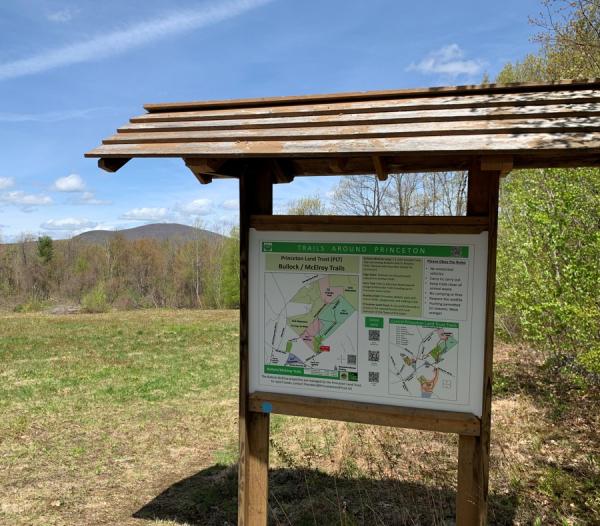
The PLT Kiosk in the PLT McElroy field (with Mt Wachusett in the background)
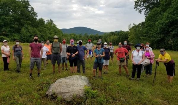
Princeton Hikers gather by the MCElroy dedication stone