

Mason Road to Red Fox Farm
HIKE NAME: Mason Road to Red Fox Farm DISTANCE: 5 Miles DIFFICULTY: Moderate
Restrictions: No motorized vehicles. No dogs or bikes. https://goo.gl/maps/5fxtkFGmfiw946zY9
Trailhead: Holden. Drive down Coal Kiln Rd toward Holden (Mason Rd) and past the Mason Farm fields. Use the DCR parking area on the right.
Hike Description: This is a pretty walk up through open field DCR property in Holden up the Princeton “escarpment” to the Red Fox/Hickory Drive area in south Princeton.
This walk is best done in the fall and winter when the field is cut and relatively dry.. It passes over a pretty road to a large uphill field, and then through the woods that are parallel to Oak Circle and Hickory Drive in Princeton. An informal trail then connects to the Red Fox Farm trail system, which also has a public trailhead off route 31. There are a few other trails that can be used to loop around the Red Fox area.
Total elevation is 500 feet.
Links: None
Hike Details:
From the parking area, head into the woods and proceed uphill through a series of pretty, open fields to a stone wall, which is just past the Princeton-Holden line. A wide trail, a popular spot for local residents, proceeds through property owned by the Nimrod Hunting Club.
Watch for the first well-defined trail to the left, and follow it a quarter mile or so until Red Fox Farm trail signs are found. Take the first left onto the Red Fox Loop and follow the trail down to a boulder area. This part of the trail goes along a stone wall and past a recently cleared DCR area…a pretty walk.
At this point, the trail can be followed to the main parking area on route 31, which goes through a pine forest and across two wetland bridges. Or the hiker can continue toward Hickory Drive on the Connector Trail to the Hickory Trail, then turn right to loop back around to the Mason fields. And back to parking.
Because this entire area is used by hunters, hikers need to take precautions during hunting season by wearing bright orange, yellow or red.
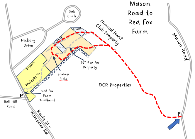
Other Options to Consider:
There are several loops that can be explored in the Red Fox area. Hikers can also start from the Red Fox Trailhead in Princeton, making a nice 2 mile hike out through the fields and to Mason Road, and then back.
Remember to consider the wetness of the top-most Mason field when making hiking plans!!
Trails on the Princeton side, including Cobb Brook, are also not far from the future Worcester Road trailhead
Rev 1/24
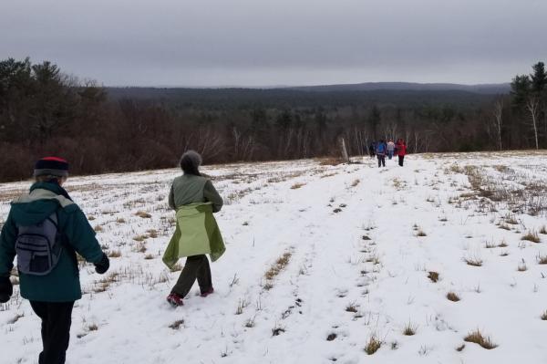
Hiking down through the Mason Fields
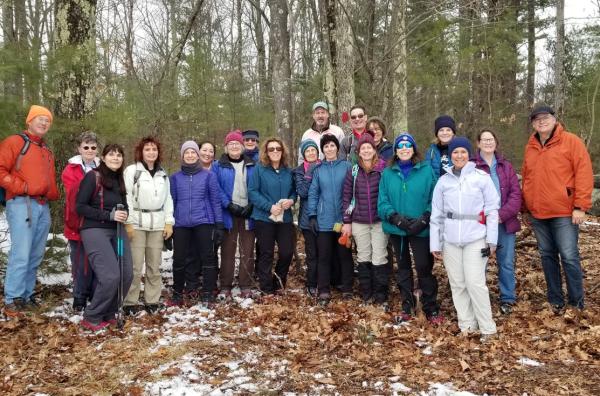
Princeton Hikers at the top of the Mason Fields, at the Holden town line