

Sterling - Lynde Basin / Wekepeke
HIKE NAME: Lynde Basin/Wekepeke DISTANCE: 3 Miles DIFFICULTY: Easy-Moderate
Restrictions: No motorized vehicles
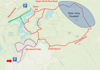
Trailhead: Sterling. Small parking lot on Heywood Road, 1.0 miles south of North Row Road and ..3 miles North of Justice hill Road. https://maps.app.goo.gl/pYkC7C2Ko6JjZRjv7
Hike Description:
Lynde Reservoir is located in the Wekepeke Wildlife Conservation Area in northwest Sterling. This area once hosted a chair factory, and was developed in the late 1800s as a water supply for Clinton.
The hike offers a loop around the property and out through the town forest, with pretty views of the water including a small waterfall, and a side walk out to a small cow field.
While some sections of the hike can be a little wet during wet periods, most of the trail is high and dry and easy walking.
Links: Sterling Lynde Basin Brochure
Hike Details:
Starting from the Allenwood parking area, proceed through the field and along a field and through the woods to the main gravel road of the Lynde Basin area. Turn right and follow the road through the woods and around to the right until you reach the area flooded by beavers. Near the beginning of this 'out and back' there is a trail that branches off briefly to a small cow pasture, which is worth the detour.
Reverse direction and return to the entrance to the Allenwood trail, but turn right to loop around through the woods until a T junction is encountered. Explore to the right, and then return to the left down by the spillway, a pretty photo spot.
Reverse direction and turn right and follow the edge of the reservoirs back to the Allenwood trail, and then return to the parking area. This walk along the reservoir is the best part of the hike.
Other Options to Consider:
There are several smaller trails in the Wekepeke area, including a spur that goes out to the northwest side of the reservoir (shown on the map in green just above the main water body).
There is a second parking area (top of map) adjacent to the Lynde Basin loop. This parking lot is smaller, but there provides easier access to the reservoirs and a shorter loop hike.
There are also some trails in the Allenwood Conservation Area that go up and over laurel-filled hills. They can be very pretty but are not always well-maintained..
Historical Notes:
The name “Wekepeke” comes from the Nipmuck name, Wickapicket, for the Wekepeke Brook (this name also appears on older maps). It is likely that the name means “the place where linden (or bass wood) trees are.” Bass wood was an important material for the Nipmucks, e.g., the long fibers in the bark were used for making rope and strings.
By the 19th century, the Wekepeke Watershed area was predominantly an agricultural region, to which smaller, water-powered commercial activities were added. A chair factory owned by J. Lynde was situated at Lower Lynde Basin. In the late 1800’s, Clinton was growing rapidly, and the local water sources were insufficient to meet the water needs. Piping gravity fed water of excellent quality from the Wekepeke Brook was the chosen solution, and to achieve this Clinton acquired the land in Sterling.
The Allenwood trail is named after Charles Allen, who farmed Crystal Brook Farm for most of his life. He was a nature lover, an avid bird watcher and a wood carver. After retiring from farming, he became an active hiker, partly on his own network of trails. Charles donated 27 acres to Sterling Land Trust in 2001.
Rev 1/24
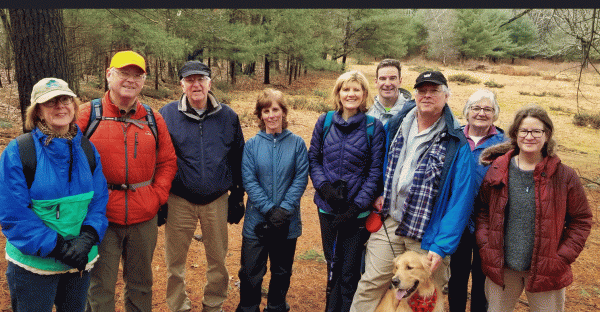
Princeton HIkers at the Small Cow Field
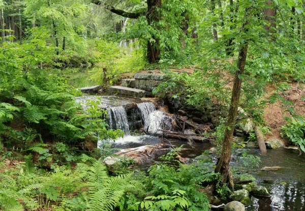
A small waterfall between the two larger ponds