

Princeton Hikes! Schedule
The Open Space Committee is leading a series of hikes in the trails around Princeton. our objectives are to showcase Princeton Hiking Trails, foster a community hiking group, and provide a safe way to explore Princeton and surrounding towns.
Current fixed plans for guided hikes are:
- Saturday April 13th at 9AM: Barre Falls Prison Camp Hike: Hike from Barre Falls out the Midstate Trail to the old Prison Camp and return via gravel roads over the East and West branches of the Ware River. 6.5 miles, Moderate.
- Wednesday April 17th at 10AM: Red Fox Farm. Hike through PLT Red Fox property out to Mason Fields and back via the Red Fox Loop trail. 3 Miles, Easy-Moderate.
- Saturday April 27th at 9AM: Mt. Wachusett East Side / Wildflowers: Hike up to High Meadow, then to the summit, returning on Old Indian, Up Road, and Bicentennial Trails. 4.5 Miles, moderate-difficult.
- Saturday May 11th at 9am: Wachusett Meadow North. A 4 mile easy-moderate hike up to Thompson Road, then back by the Glacier Boulder and around Brown Hill.
- Wednesday May 15th at 10am: PLT Hike from Krashes Field to the Beaver Pond and back. 3 Mile easy-moderate hike.
- Saturday May 25th at 9AM: Hike the west side of the Wachusett Reservoir, out to Sholan Point and over gravel roads. 4-miles, moderate hike.
To register for these hikes, or to join the Hikes mailing list, and get early information about each hike, write to TrailAroundPrincetonMA@GMail.com.
Also note: We have separated the longer hikes that are outside of the Princeton area (for example White Mountain hikes, Wapack Trail, etc) and are now managing those off a separate project that is not associated with the town of Princeton. Write to Rick.S.Gardner@GMail.com if you would like to join that group.
Contact: Email or Call Rick at 978-660-8664. Follow Facebook "Trail Around Princeton" site.
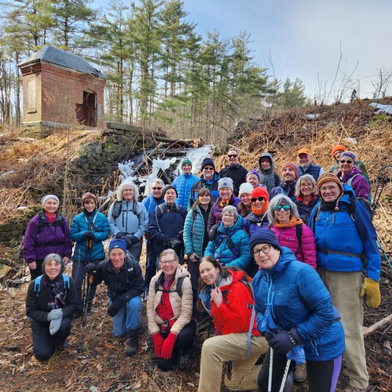
At Leominster State Forest in September 2023.. We hiked up the White Oak Trail and then down Berry Hill and Boardwalk before finishing in the Paradise Pond area.
A little more info about Princeton Hikes
The Princeton Hikes! Program
The Princeton Hikes! program was established by the OSC to provide opportunities for guided group hikes in and around Princeton. The hikes are open to all and both beginner and more difficult hikes are available.
All of the hikes in this website have been taken by the Princeton Hikes! Group over the past several years. We hope that the website serves as a useful reference for hikers in the area. We encourage submission of new hike ideas and corrections…write to TrailAroundPrincetonMA@GMail.com for information or suggestions.
Here are a few key points about our hiking program:
- All are welcome. We hike at the rate of the slowest participant, but often the hikers split into smaller groups and then wait at intersections for people to catch up. We welcome hikers from all towns, though our 'marketing focus' is the town of Princeton.
- Our normally scheduled hikes occur two Saturdays and one weekday per month, and are typically in Princeton or surrounding towns. Because a major goal of the program is to introduce people to local trails, we do not often go far afield from Princeton. There is a separate private group available in town for more 'adventurous hikes' to places like Watatic, Monadnock, and the White Mountains.
- We hike year-round. In the winter we may require certain footwear, such as microspikes (often!), snowshoes, or cross country skis. Some of our winter hikes are likely to change just before the date to take advantage of snow conditions.
- Dogs are allowed for hikes where the landowner allows them. Some areas, such as Audubon Sanctuaries and DCR Wetland properties, do not allow dogs. In general we ask that dogs are constrained by a short leash; however, this requirement is relaxed if dog behavior permits! Please contact us if you are considering bringing your dog along!
Trails Around Princeton (TAP) Program
Trails Around Princeton (TAP) is an ongoing project of the Open Space Committee that seeks to proactively develop, document, and improve the existing network of trails and their connections to one another.
Difficulty Ratings
- Difficult: The most difficult hike is the climb of Mt. Wachusett from the North. This hike involves about 1000 feet of elevation gain, with rocky trails and five miles or more of distance.
- Moderate: Moderate generally means the elevation gain is roughly half the elevation of Mt. Wachusett (300-500 feet), with perhaps less distance or easier footpaths.
- Easy: Generally under three miles and under 300 feet of elevation gain, with pretty smooth pathways.